THE PROGRAM:
The trekking of the Mont Avic lakes develops in the two valleys of the Park (Chalamy and Champorcher), for a length of about 44 km and a positive gradient of about 3.000 m. About 8 hours of average walking time per day. Positive gradients from 650 to 1.350 meters. A good physical and health condition is required. Plan a good workout before you leave.
In short:
- Duration: 3 days/2 nights
- Overnight: 2 nights in huts (Barbustel and Dondena) with half board (dinner and breakfast).
- Total elevation gain: about 3.000 m
- Length: about 44 km
- Kind of activity: group trekking in total autonomy with hiking guide and no luggage transport service during the activity
- Altitude of the highest point of the trek: about 2.910 m (Col Fussy)
TOUR OF THE MONT AVIC LAKES GROUP DEPARTURES
RATES
- Price on request. Contact us for a personalized quote. XXX
THE RATE INCLUDES
- liability insurance
- the assistance of certified Guide
THE RATE DOES NOT INCLUDE
- research and rescue insurance with UVGAM coverage (recommended): €5 per person for 3 days
- the certified Guide’s expenses (transfers, meals and accommodation) to be covered by participants
- nonspecificato
LIVE THE ADVENTURE, SHARE THE EXPERIENCE
We believe that adventure is the soul of life. Our mission is to inspire people to be able to overcome their limits. Such as the spirit created between rope partners, we believe in the value of sharing experiences and emotions
LIVE THE ADVENTURE
We believe that adventure is the soul of life. Our mission is to inspire people to be able to overcome their limits.
SHARE THE EXPERIENCE
Such as the spirit created between rope partners, we believe in the value of sharing experiences and emotions
TOUR OF THE MONT AVIC LAKES ASCENT DAY BY DAY
Route: Barbustel hut – Grand Lac – Col Medzove – Col Etsely – Col Fussy – Misérin hut – Dondena hut
Meeting Point: ore 12:30PM Verres and transfer to Covarey (Champdepraz) using your own car (transfer NOT provided)
Elevation gain: +950 m / -40 m
Total time: 4 h
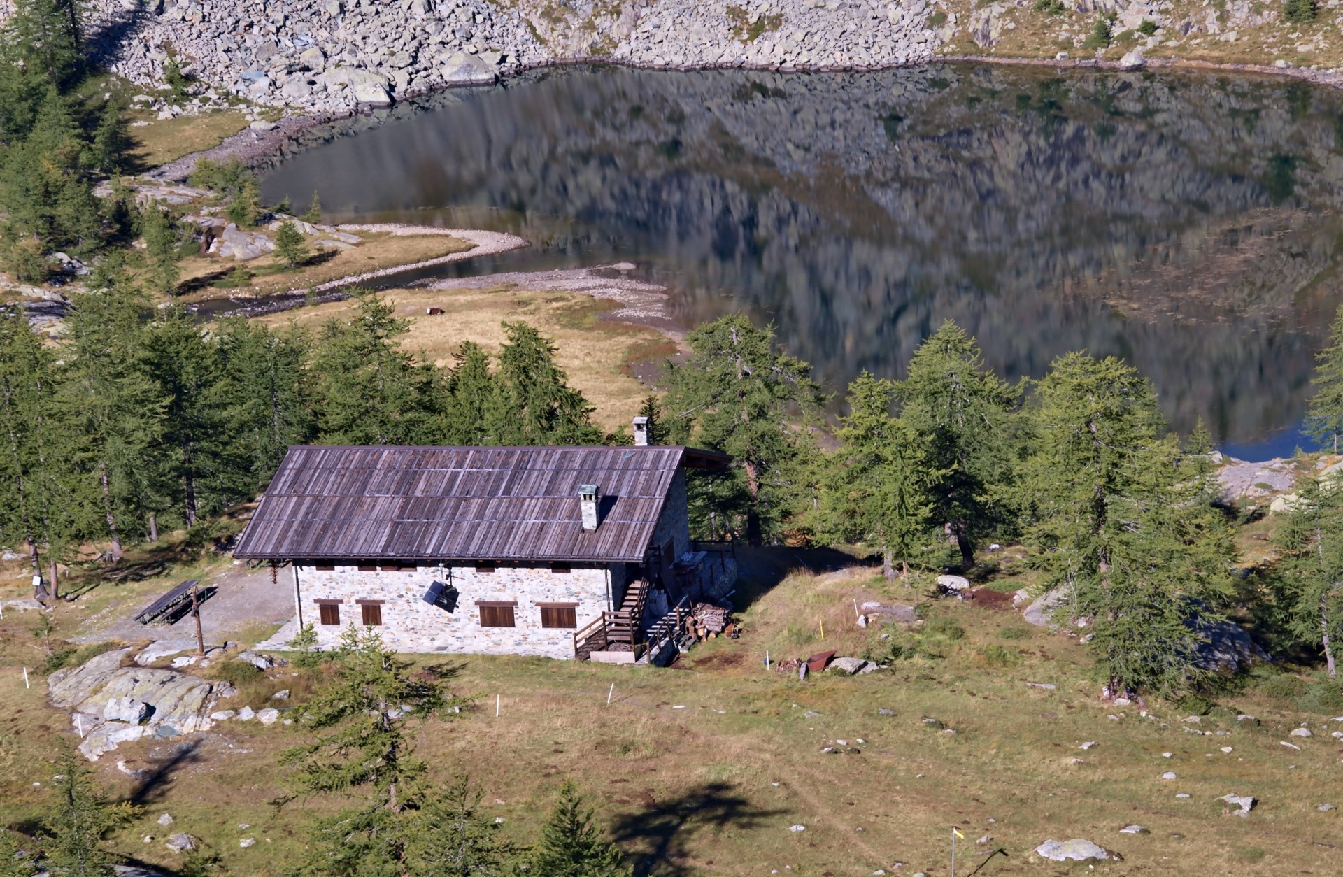
The itinerary begins in Veulla (1.298 m), where we take a dirty road that runs along the valley floor of the Chalamy valley as far as the hamlet Magazzino (1.461 m). The trek of the Mont Avic lakes continues towards Alpe Serva-désot (1.540 m), after that we take a path that leads into the pine forest before reaching Lac de Serva (1.801 m). From here, we reach the Cousse Alp first (2.059 m a.s.l.) and then the Lac Blanc (2.154 m) upstream of which is the Barbustel Refuge (2.200 m).
Route: Barbustel hut – Grand Lac – Col Medzove – Col Etsely – Col Fussy – Misérin hut – Dondena hut
Elevation gain: +1.350 m / -1.330 m
Total time: 8/9 h
From the Barbustel Refuge (2.200 m) we first reach Lac Cornu and then the Gran Lac (2.485 m). From here, we follow route 5c-102 which leads to Col Medzove (2.613 m) and then downhill to reach Lac de Mezove (2.372 m), where the ascent to Col d’Etsely begins (2.812 m). The trek of the Mont Avic lakes continues along the route of the old royal road that leads to Col Fussy (2.910 m asl). From here you can go directly to the Rifugio Dondena (2.189 m.) or take a wide loop to reach Lac Pontonnet first, located in a glacial basin at an altitude of 2.702 m. and then Lago Miserin (2.580 m), with its characteristic Dondena shelter-hospice.
Route: Dondena hut – Lac Muffé – Col de la Croix – Léser- Dessus – Veulla
Elevation gain: +1.350 m / -1550 m
Total time: 7/8 h
Left the Dondena hut, after a descend for a short distance we take the local path 9c which will allow us to touch all the lakes located on the orographic left of the upper Champorcher valley, in order: Lac Giasset, Lac de Raty, Lac Vernouille, Lac Muffé , where there is a restaurant. Here we take the path that leads to the Col de la Croix (2.286 m), in a very suggestive setting with a splendid panoramic view of the Matterhorn and the Monte Rosa massif. From here, the trek to the Mont Avic lakes continues downhill, before reaching Lake Leser (2.011 m), surrounded by wetlands (peat bogs), then the pastures of Léser-Dessus (1.907 m) and Léser- Dessous (1.778 m asl), and finally quickly lose altitude to Veulla, the final stop on this splendid 3-day itinerary.
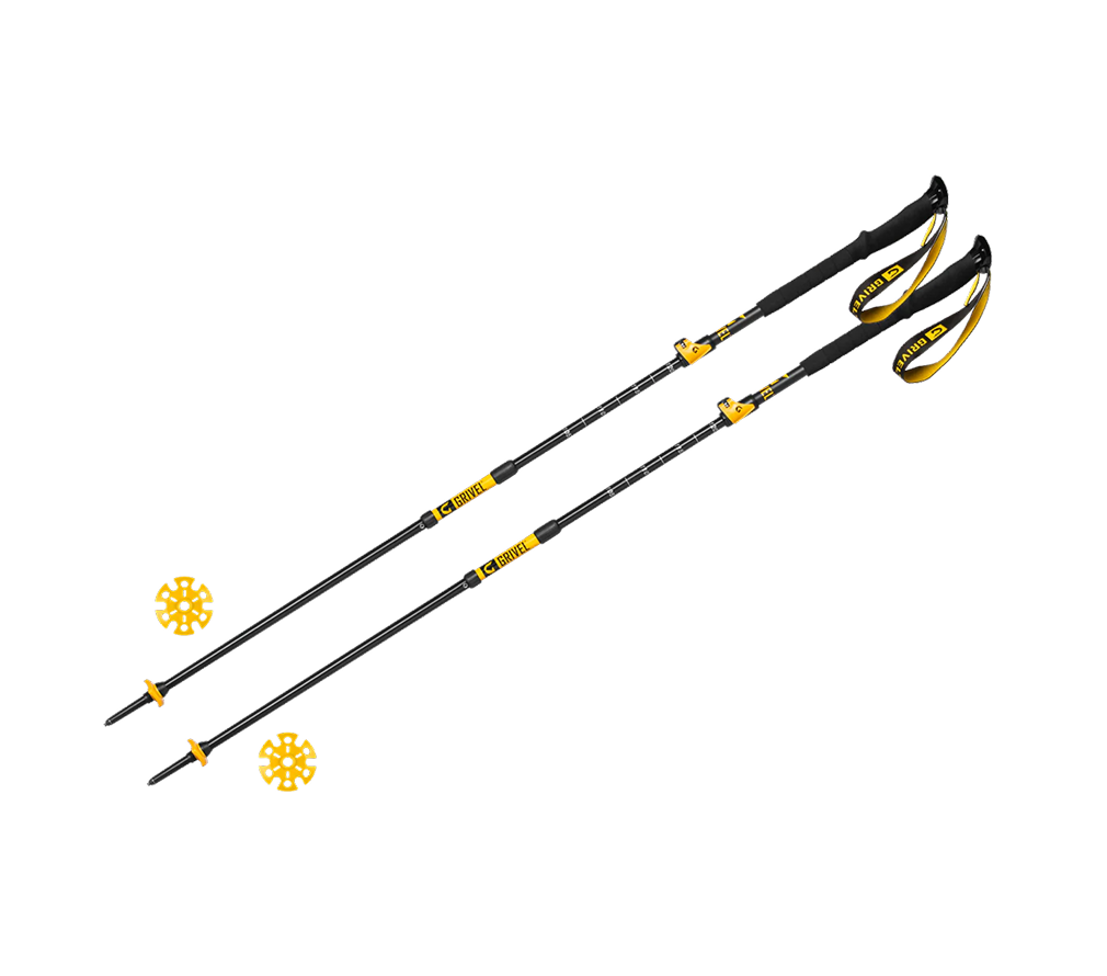
EQUIPMENT REQUIRED

NOTES
- It is crucial that participants follow all instructions provided by the mountain guides before and during the activities, and that they accept any changes made to the programme in order to guarantee their safety.
- Fees for lift facilities, transfers and mountain lodges are subject to changes established and applied by they respective owners. without any liability attributable to PEAKSHUNTER Mountain Guides.
- The rates listed in the “The rate does not include” section are to be considered merely indicative and are therefore subject to changes.
- PEAKSHUNTER Mountain Guides reserves the right to change any route or activity programme based on conditions (weather, accessibility, refuge) and participants’ fitness level.
- The dates indicated for the activities may change due to weather, snow, or soil conditions, etc. In addition, they depend on the date of opening / closing of the lift facilities, which are established seasonally/yearly by the managing entities of the same and, therefore, are not in any way attributable to PEAKSHUNTER Mountain Guides.
Technical difficulty